Data Access - Stations
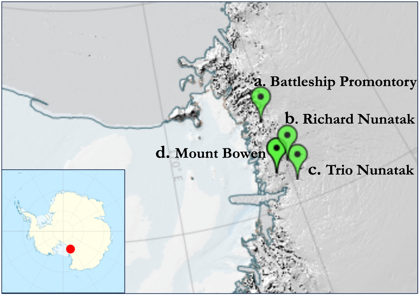
| Map of stations installed in Victoria Land: | ||||||||||
| a. | Battleship Promontory | (76° | 54' | 4.56'' | S - | 160° | 54' | 36.3'' | E, | 788 m asl) |
| b. | Richard Nunatak | (75° | 56' | 6.8'' | S - | 159° | 47' | 59.01'' | E, | 1860 m asl) |
| c. | Trio Nunatak | (75° | 28' | 56'' | S - | 159° | 35' | 28'' | E, | 1470 m asl) |
| d. | Mount Bowen | (75° | 45' | 24'' | S - | 161° | 03' | 46'' | E, | 1689 m asl) |
|
|
||||||||||